Overview
Harpia Technologies Domestic Ground Station is the world's first central control point for UAV operations encrypted with crypto hashes. The system performs critical functions such as simultaneously controlling multiple UAVs, collecting and analyzing real-time data, and planning and managing missions.
Developed by our domestic software development team, the system can be integrated with different UAV platforms thanks to its modular structure. Its user-friendly interface and advanced features enable operators to work efficiently.
Technical Specifications
Engineering and Technology
Software Architecture
A scalable and modular software structure developed using microservice architecture. Each module can operate independently and be updated without affecting the overall performance of the system.
- Microservice-based architecture
- RESTful API integration
- Real-time data processing
- High availability (uav) support
Data Processing
Raw data from UAVs is processed, analyzed, and visualized in real time using advanced data processing algorithms. AI-powered data analysis modules are integrated.
- Real-time data stream processing
- Video codec optimization (H.264/H.265)
- Telemetry data analysis
- Machine learning-based anomaly detection
Mission Planning
With advanced mission planning software, operators can plan, simulate, and manage UAV missions in detail. Waypoint-based navigation and autonomous mission execution support are available.
- 3D mission planning interface
- Waypoint and route optimization
- Mission simulation
- Dynamic mission updates
User Interface
The modern and intuitive user interface enables operators to work efficiently on the system. It features customizable dashboards and multi-screen support.
- Customizable dashboard
- Multi-screen support
- Touchscreen compatibility
- Dark mode support
Key Features
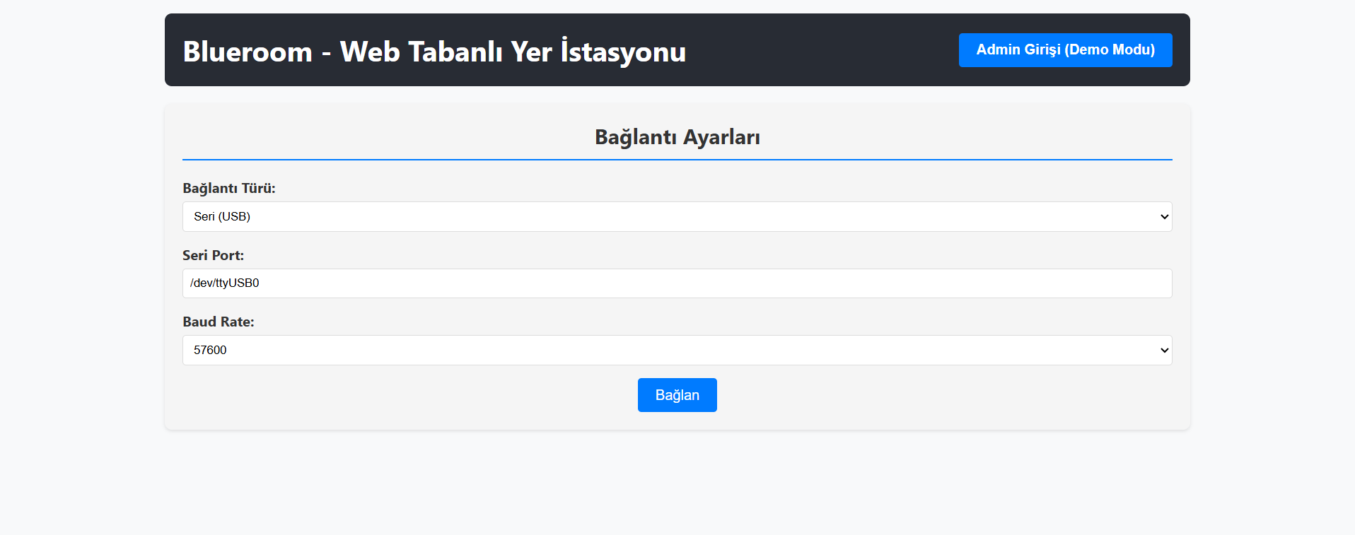
- The web-based ground station blueroom is encrypted with Harpia-CRYPT and is the first domestic and national web-based ground station.
- Multi-UAV Control - Simultaneous control and management of up to 16 UAVs
- Real-Time Data - Visualization of instant telemetry, image, and sensor data
- Advanced Mapping - 3D map view, waypoint planning, and route optimization
- Data Recording and Archiving - Recording and archiving of all operational data
- Secure Communication - Secure data communication with AES-256 encryption
- Modular Design - Easy integration and expandable architecture
- Artificial Intelligence Support - AI-powered data analysis and anomaly detection
- High Availability - Redundant system architecture for uninterrupted operations